
| We had a guest visiting in June 2010 and I got to brush up on my tour guide qualifications. I took my camera along and took a few pictures of the area. We made day trips around the South Coast of Oregon with an occasional foray into the interior. |
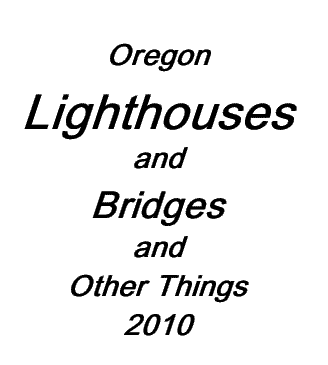
| The Cape Arago Light located north of Cape Arago near the mouth of Coos Bay. This 44-foot tall lighthouse was first lit in 1934. It was decommissioned in 2006. Current plans call for it to be turned over to local Native Americans, who suddenly remember it is one of their sacred grounds. |
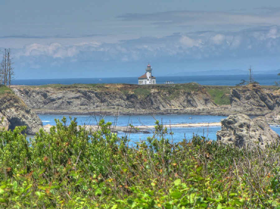
| The Coquille River Light located on the north spit just north of the town of Bandon. This lighthouse was commissioned in 1896 and decommissioned in 1939. Today it's one of the features of Bullards Beach State Park. |
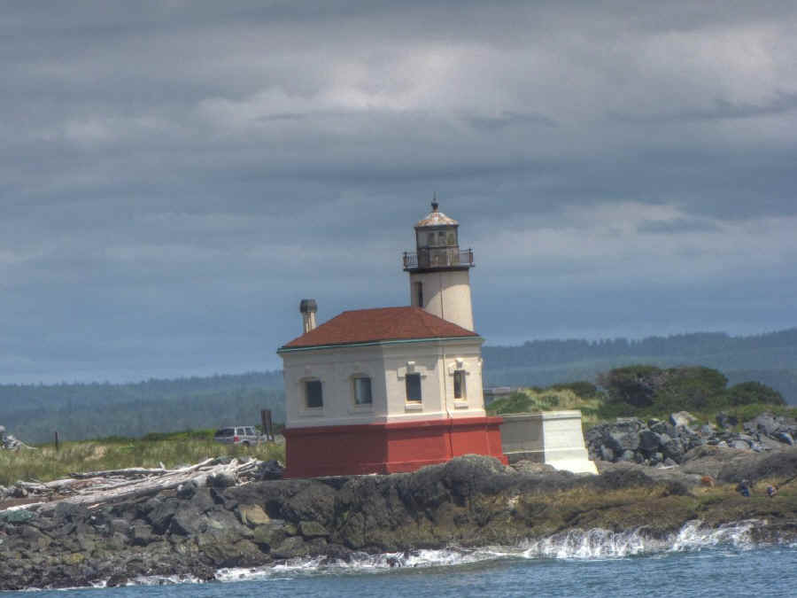
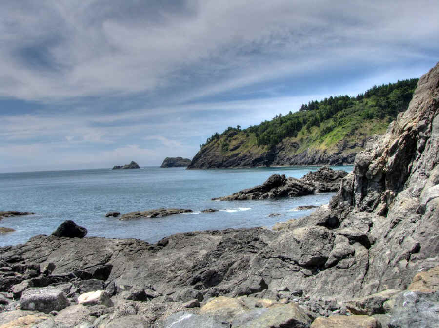
| Face Rock, one of the myriad of rocks known collectively as the Oregon Islands. This one is located just south of Bandon. The aboriginal occupants of the area supposed it to be the head of a reclining princess of their culture, a long syrupy legend which I'll leave untold. |
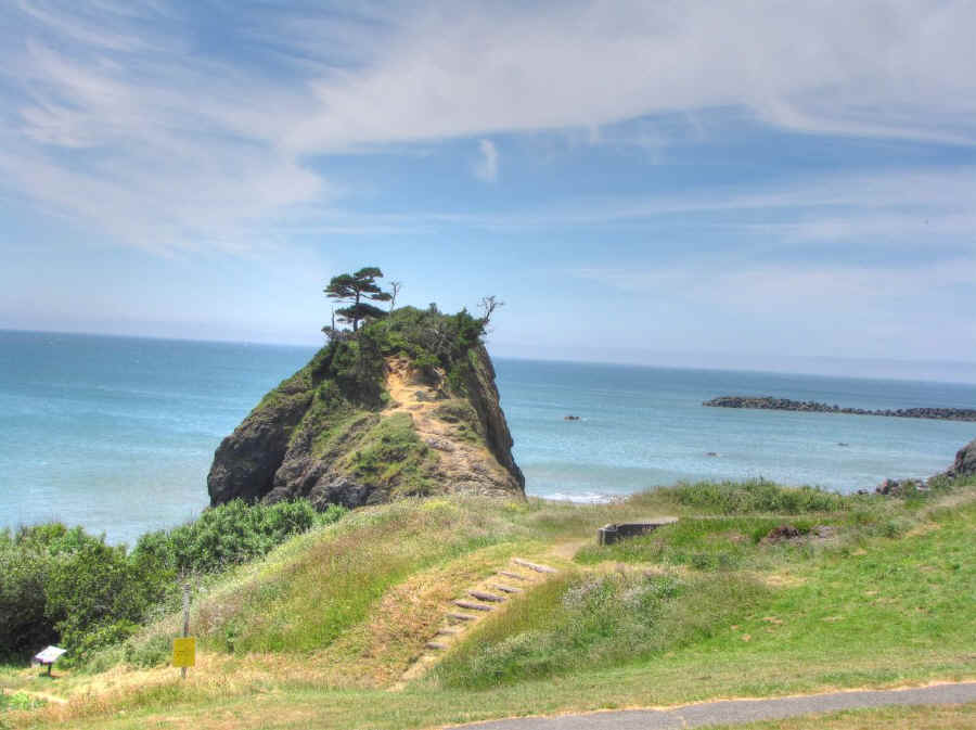
| Battle Rock, an "island" separated from the mainland by a few feet of water at high tide, is located at Port Orford. It was the site of a minor skirmish between white prospective settlers and the local Qua-to-mah Indians in 1851. The attacks of the latter were foiled by the invaders firing a small-bore cannon at point blank range a couple of times. The lull in the "battle" allowed the frustrated would-be settlers to escape after dark to walk back to Astoria (over 300 miles away). The ship from which they had landed had already sailed for San Francisco. |
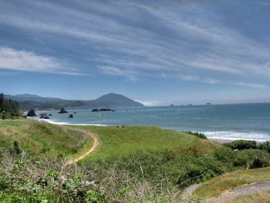
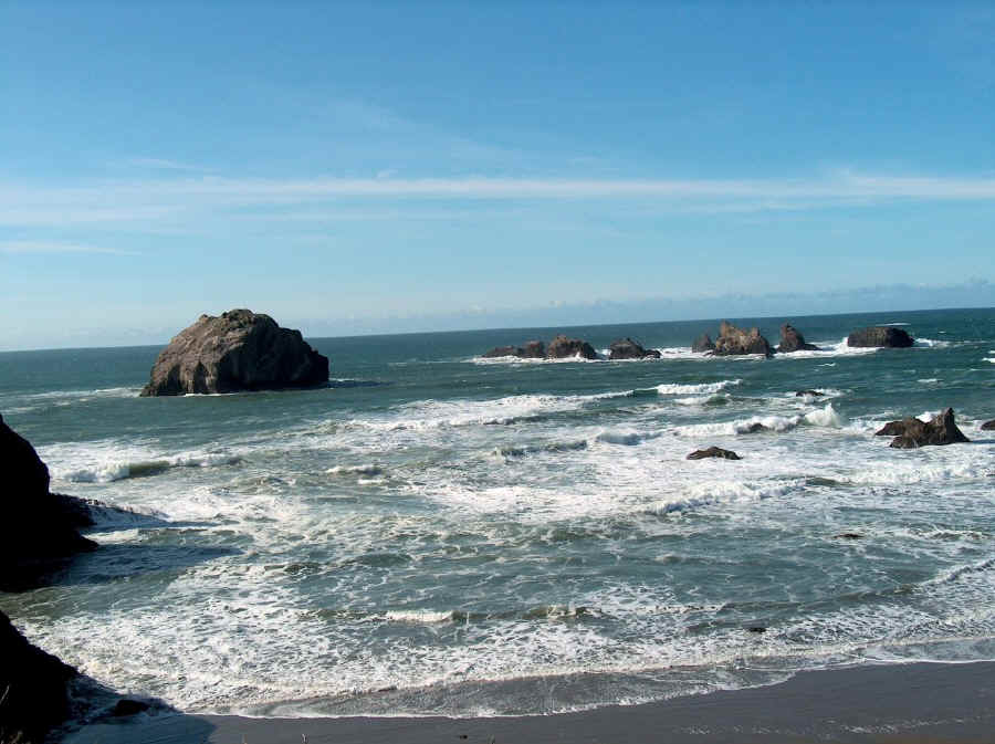
| A view of the coast to the south from Port Orford. |
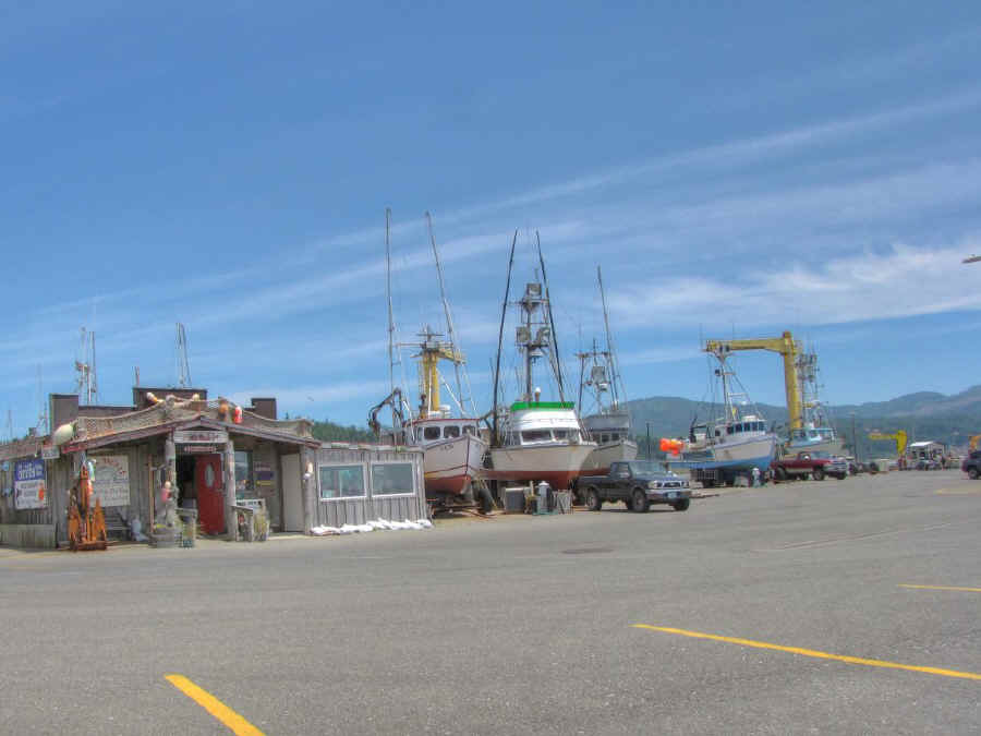
| The harbor at Port Orford. It boasts the only remaining American dry dock on the west coast. The building houses a seafood restaurant. |
| A view of the coast from Port Orford looking north. |

| The Hughes House, located in Cape Blanco State Park, was built for Patrick and Jane Hughes on their ranch (the present park) in 1898. The house has been lovingly restored and maintained with period furniture. Tours are given by hostesses in period costume. |
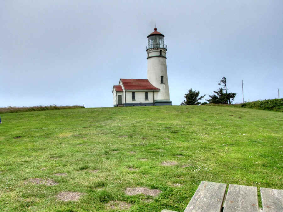
| The Cape Blanco Light with a 59-foot tower was commissioned in 1870 and is still in use (under automatic control). The cape is claimed to be the westernmost point of land in the continental United States. This record is disputed by Cape Alava, Washington, which claims the distinction. The truth depends on tides and measurement methods. One thing that can be guaranteed is that Cape Blanco has the most consistent high winds of any place in Oregon. |
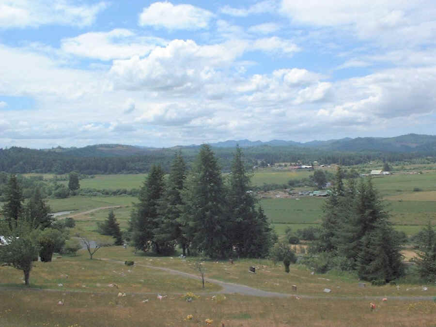
| The Coquille River Valley where we live provides us with easy access to the coast without the meteorological hardships. Winters are still tough enough though. |
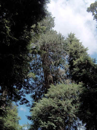 |
One of our side trips was into the Siskyou National Forest where we visited The Big Tree, the largest Port Orford Cedar known. It towers 232 feet in the air, has a base circumference of 43.5 feet and the branches extend 35 feet. Access is up a perilous dirt and gravel road which experiences frequent slides and fallen trees. The 6 mile long uphill drive took about 45 minutes and easily took a few years off my lifespan. |
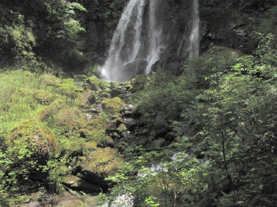
| We also visited Elk Creek Falls in the Sikyou National Forest. It's located a few miles south of the town of Powers on USFS Road 33. A quarter mile climb up a shaded moss-covered trail brings you into the clearing on a ledge overlooking Elk Creek. The water tumbles 150 feet down the side of the cliff. Elk Creek flows into the South Fork of the Coquille River. |
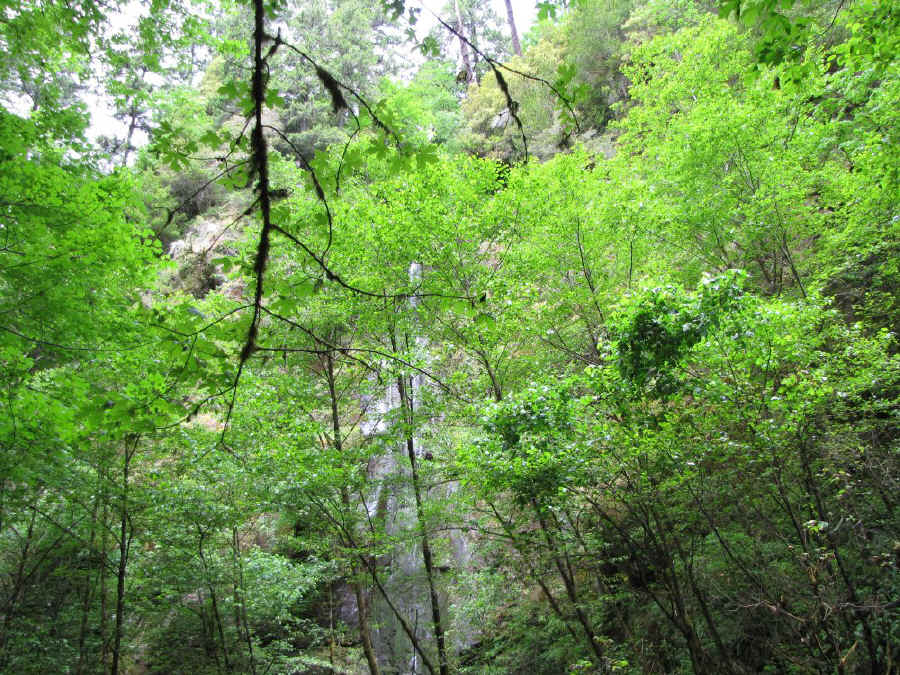
| A subsidiary falls at Elk Creek which only flows in the spring and early summer. |

| Another stop was near the town of Remote, Oregon, where we visited the Sandy Creek Covered Bridge. Built on the Myrtle Point-Roseburg Road in 1921, the bridge was designed strong enough to withstand the weight of fully-laden logging trucks. When the road (now Oregon State 42) was improved in 1949, the bridge was bypassed but remains in it's original location. |
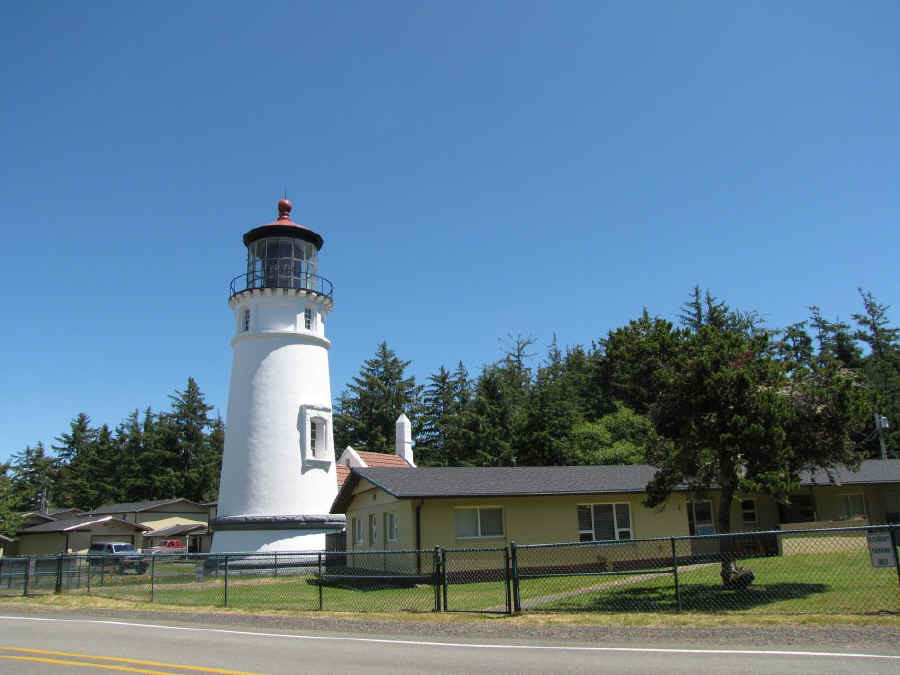
| The Umpqua Light is located in an homonymous state park near Winchester Bay near the mouth of the Umpqua River. It was commissioned in 1894, automated in 1966, and is still in operation. The tower is 61 feet tall. |
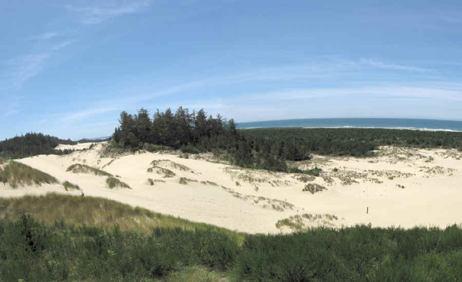
| The Oregon Dunes National Recreational Area is a pile of sand covering over 27,000 acres and extending from North Bend to Florence. Even though it's a favorite of ATV lunatics, numerous species of wild life still flourish in the forested "islands" in the sand. |
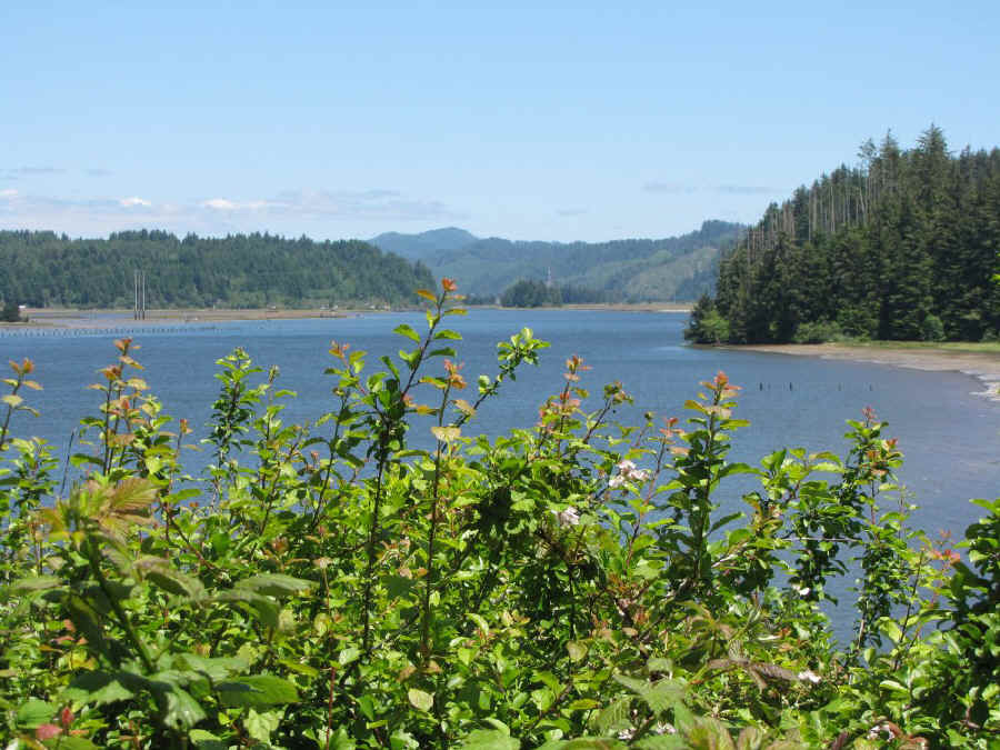
| Looking upstream on the Siuslaw River near Florence. |
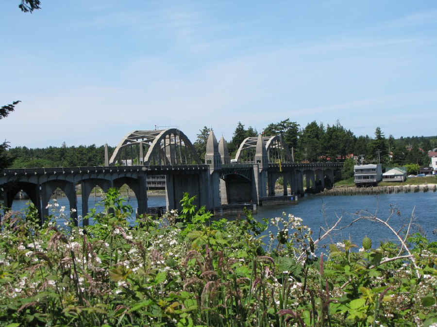
| The art deco Siuslaw River Bridge at Florence. The bascule bridge was designed by Conde McCullough, who designed all the bridges along the Oregon coast. It was completed in 1936. The total span length is 1568 feet. When the double bascule sections are opened, they provide 110 feet of horizontal clearance for vessels entering the river from the ocean. |
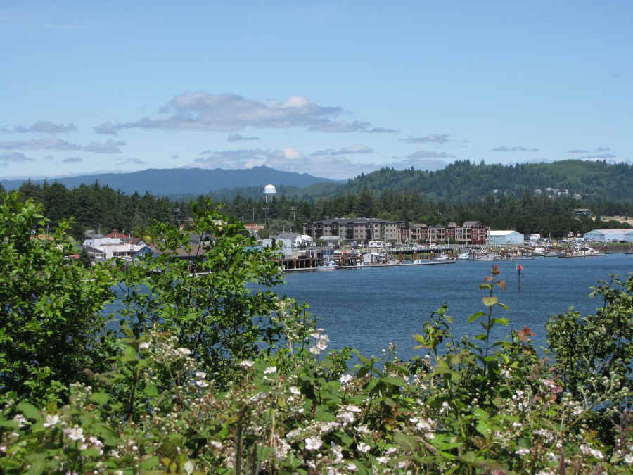
| Florence, Oregon, population 8,270, one of the most attractive cities on the Oregon coast. |

| Eleven miles north of Florence is the marine attraction that is quite unique. The picture above is taken from the lower deck of the souvenir store at Sea Lion Caves. The lower deck is two stair flights below the surface. Then you walk down the pathway to the upper elevator house (shown above) descending another 150 feet. The elevator has only one stop: 200 feet below in the observation area built into the ocean grotto occupied by numerous sea lions. |
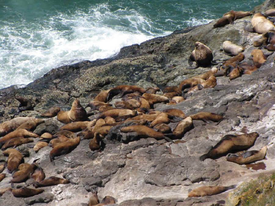
| On the walk down to the elevator, a glance over the seaward rail reveals a bunch of them out sunning themselves on the rocks outside the cave. Most of those above are Harbor Seals. The larger ones in the upper right are Steller or Northern Seals. Over the past year there has been an unusual influx of California Seals. They are possibly abandoning California due to the shaky economic conditions there. |

| A shot into the main grotto of Sea Lion Caves. According to Guiness, this is the largest sea cave in the world. |
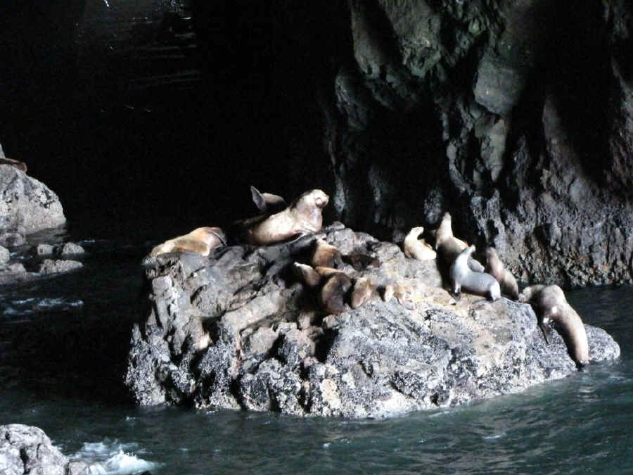
| A group of Steller Seals atop a rock in the cave. In the observation room conversation is difficult due to the incessant barking of the seals. The smell is enough to cancel your appetite for a few days. |
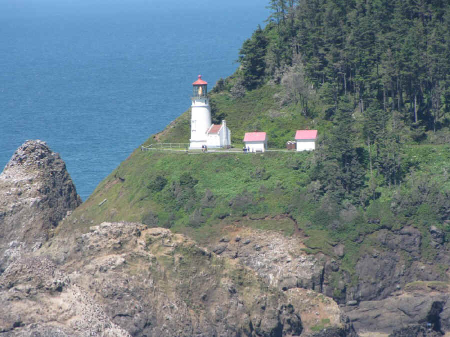
| One of the openings in the cave observation room affords a good view of Heceta Head Light. The 56-foot tall light was built in 1892 and automated in 1963. With it's visibility range of 21 miles to sea, it is the strongest light of any Oregon lighthouse. |

| Heceta Head with the light (left) and the lighthouse keeper's house (right). The former is maintained by Oregon Parks and Rec and the latter by the US Forest Service. |
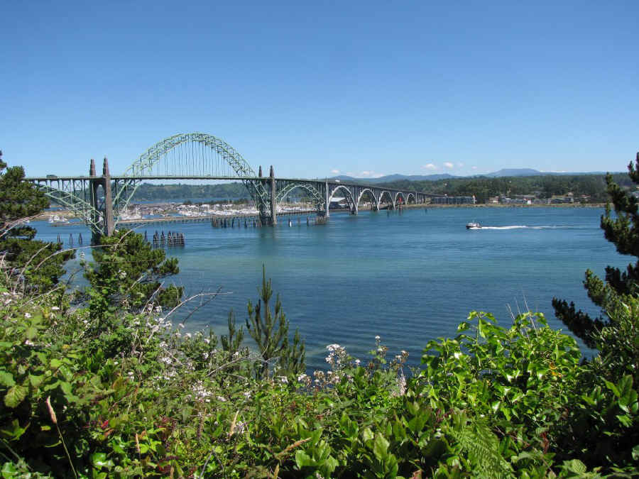
| The Yaquina Bay Bridge at Newport was another Conde McCullough design. It was built in 1936. Total length is .982 miles. The 133 foot vertical clearance above the water allows vessels to enter from the ocean. |
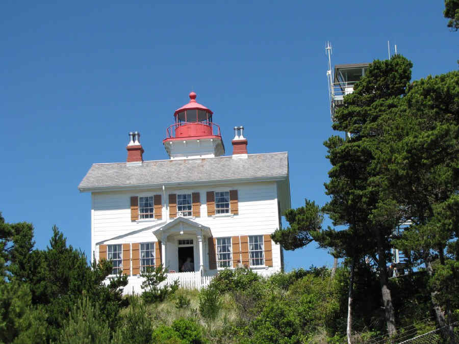
| The Yaquina Bay Light is located just seaward of the bridge on the north side of the water. The 51-foot tall structure was built in 1871. It was only used as a lighthouse for 3 years as the construction of the Yaquina Head Light a few miles north obviated the need for the bay light. |

| The Yaquina Head Light is located on a tract of land which is today administered by the US Bureau of Land Management (BLM) as the Yaquina Head Outstanding Natural Area. At 93 feet tall, Yaquina Head is the tallest of Oregon lighthouses. It was built in 1873 and was originally called the Cape Foulweather Light. It was automated in 1966. |
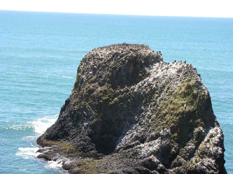
| Many of the nearby sea stacks act as rookeries for the sea birds and sea mammals. This one is covered with birds. |

| A closer shot of some of the cormorants occupying a rock top rookery. |
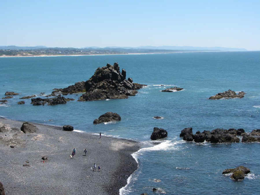
| A portion of the beach and sea rocks at Yaquina Head. |
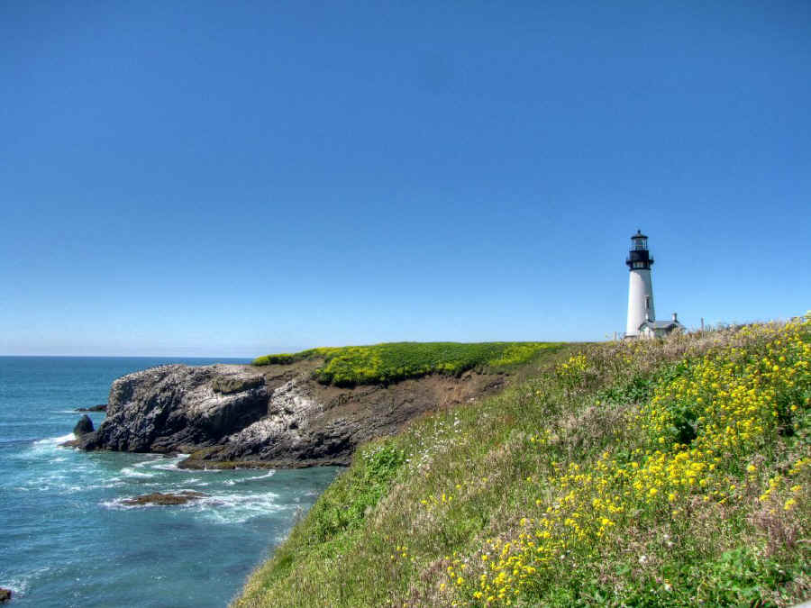
| Yaquina Head and the light.
|