

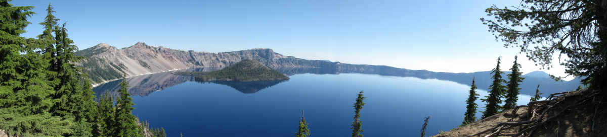
| In June of 1853, one of the ubiquitous grizzled-old-prospectors-with-a-mule, John Wesley Hillman climbed a ridge in southern Oregon in his search for gold. What he found instead was a very deep, very blue, magnificent lake in the caldera of a volcano. In the early 20th century, Crater Lake came under the protection of the U.S. Park Service. It's depth (1,943 feet) makes it the deepest in the United States and one of the deepest in the world. The purity of it's water makes it the cleanest body of water on the planet. In July of 2009, we took a too-short vacation there. |
| A view from State Highway 230 of where Mt. Mazama used to be. A roadside marker states, "One Violent Moment" "If you were standing at this spot 7,700 years ago when Mt. Mazama exploded, you would have been vaporized. A 2000° F fiery avalanche of incandescent rock fragments and gases hit this site at over 200 miles per hour. After the initial blast, a river of pumice ash traveled toward the Rogue River Valley, burying everything in it's path." The peak of Mt. Mazama was calculated to have been at elevation 12,000 feet. The four peaks which are remnants of Mazama and show above are (left-right) Llao Rock (8046 ft), Red Cone (7372 ft), Hillman Peak (8156 ft), and The Watchman (8025 ft). According to the Klamath Indians, the destruction of Mount Mazama was brought on by a terrific battle between the Sky God Skell and Llao, the God of the Underworld. I guess that's a plausible theory. |
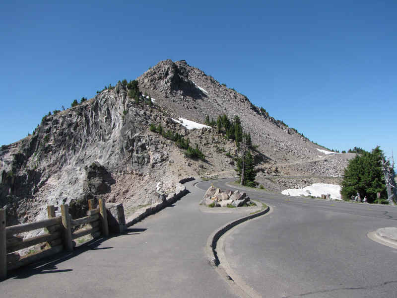
| Rim Drive is a 33-mile paved highway circling the lake. It has numerous turnouts for observation. The entire roadway is usually open only about 2 months of the year due to the snow pack. During those 2 months, highway repair crews work feverishly to maintain it. This year the complete loop was not open until the last week of July. Probably not much chance it will stay open beyond early October. Crater Lake has an annual snowfall of 44 feet. The picture above shows Rim Drive as it skirts The Watchman. The lake is off to the right. |
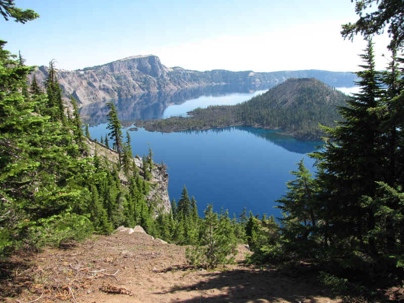
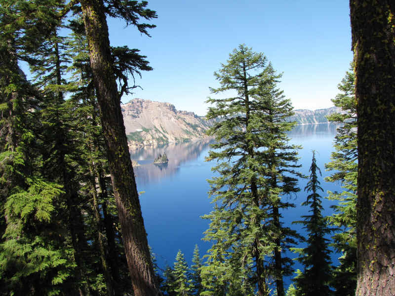
| The most prominent and well-known feature at Crater Lake is Wizard Island located near the west end of the lake. The island is a volcanic cinder cone projecting 755 feet above the surface of the water. The island covers some 315 acres. A volcanic crater at the top is some 500 feet in diameter and 100 feet deep. Access to Wizard Island is limited to tour boats which depart from Cleetwood Cove on the north side of the lake. To access the boat though, one must walk down (and return back up) a rough trail down the side of the caldera. The return climb is equivalent to climbing 65 flights of stairs. I demurred in consideration of my age and contented myself with viewing Wizard Island from several locations near Discovery Point. |
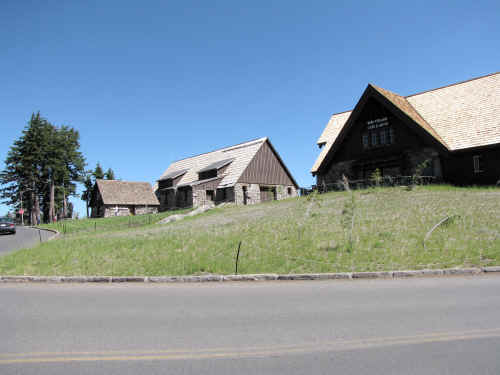 |
There are only two human developments of any size within the limits of Crater Lake National Park, both run by concessionaires. Rim Village (at left) is on the southwest corner of the crater rim. Mazama Village is located a few miles south of there near the main park entrance. Both are tastefully limited for minimum impact on the scenery. Both have gift shops, interpretive centers, restaurants, lodging, and (nicest of all) clean air-conditioned toilet facilities with flush toilets and water. There is a gas station at Mazama Village. |
| Another familiar site to the more astute observer is Crater Lake's "other" island...........The Phantom Ship. It is a 400,000 year old chunk of erosion resistant rock, the oldest exposed rock in the chaldera. It is close to the southeast shore of the lake and is as tall (above water) as a 16-story building. The above picture was taken at (appropriately enough) Phantom Ship Overlook on East Rim Drive. |
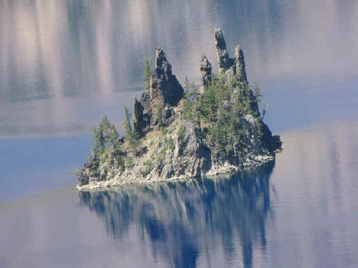
| A telephoto close-up of The Phantom Ship. |
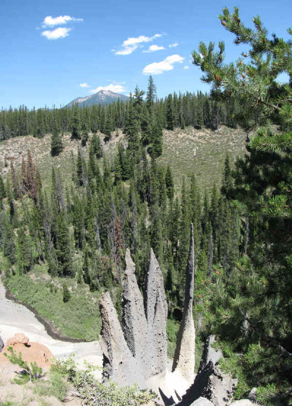
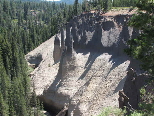
| On the east side of Crater Lake there is a spur road off Rim Drive that follows a valley down 10 miles to some exotic-looking remnants of the Mazama eruption. Gas venting up through the lava formed vent tubes and the gas brought with it heavier minerals which lined those tubes. Many centuries later, the softer surrounding soil was eroded away and left exposed these vent tubes which are now called The Pinnacles. This picture is looking down into the valley of The Pinnacles from the roadway. Mount Scott (elevation 8929 feet) showing in the background is the highest point in the National Park. |
 |
 |
| More tubular formations at The Pinnacles. |

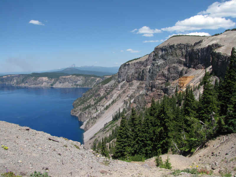
| Although I couldn't make the climb up The Watchman due to my advanced age, I was able to drive up to the same elevation on the east side of the lake. There, at Cloudcap Overlook (elevation 8000 feet) I was able to see and photograph the entire lake from 1700 feet above the water surface. The maximum width of Crater Lake is about 6 miles. Wizard Island is visible on the right. |
| Another geological feature which attracts attention is the Pumice Castle on the east side of the lake. A large isolated deposit of pumice deposited by the Mazama eruption 7,700 years ago has been eroded into a shape regarded by many as reminiscent of a medieval castle. |

| A closer view of Pumice Castle. |
 |
 |
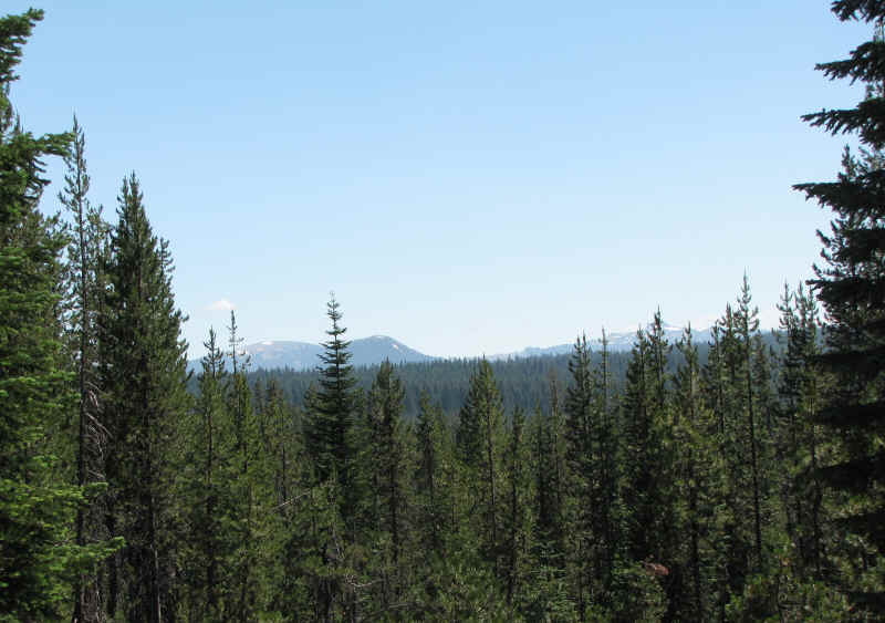
| The area has a plethora of beautiful scenery. Though popular, it's remoteness keeps the tourist population down somewhat. |
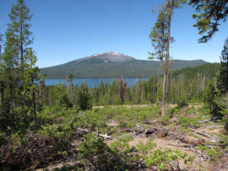
| Diamond Lake located about 20 miles north of Crater Lake (and not in the national park) has received the opposite type of care by man. Whereas Crater Lake has been kept as natural and pristine as possible, Diamond Lake is surrounded by RV campgrounds and it's waters are constantly churned by power boats and jet skis. On several occasions, the ecological balance of the lake has been upset by the thoughtless introduction of alien fish species which have been eliminated only by a total poisoning of the lake. Current theories are that Diamond Lake was formed after the Mazama eruption when lava debris dammed the valley through which streams flow. In the background is Mount Bailey (elevation 8375 feet), a shield volcano. |
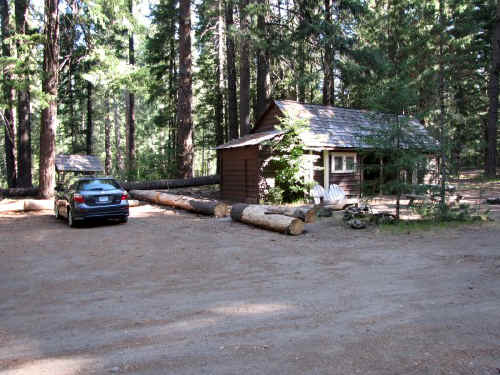 |
Since we didn't visit Crater Lake to socialize, we passed the lodges by in favor of renting this cabin down in Union Creek about 14 miles south of the park. It may not look like much but it is a National Historic Site. |
| We took our best friend Max along because he needed a little vacation too. The owners of the cabin allowed him to stay in the cabin....for an extra charge. I figured that if Max was a paying customer, he was certainly entitled to a bed. | 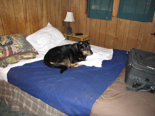 |